No app. No data. No problem.
AI outdoor assistant, via SMS.
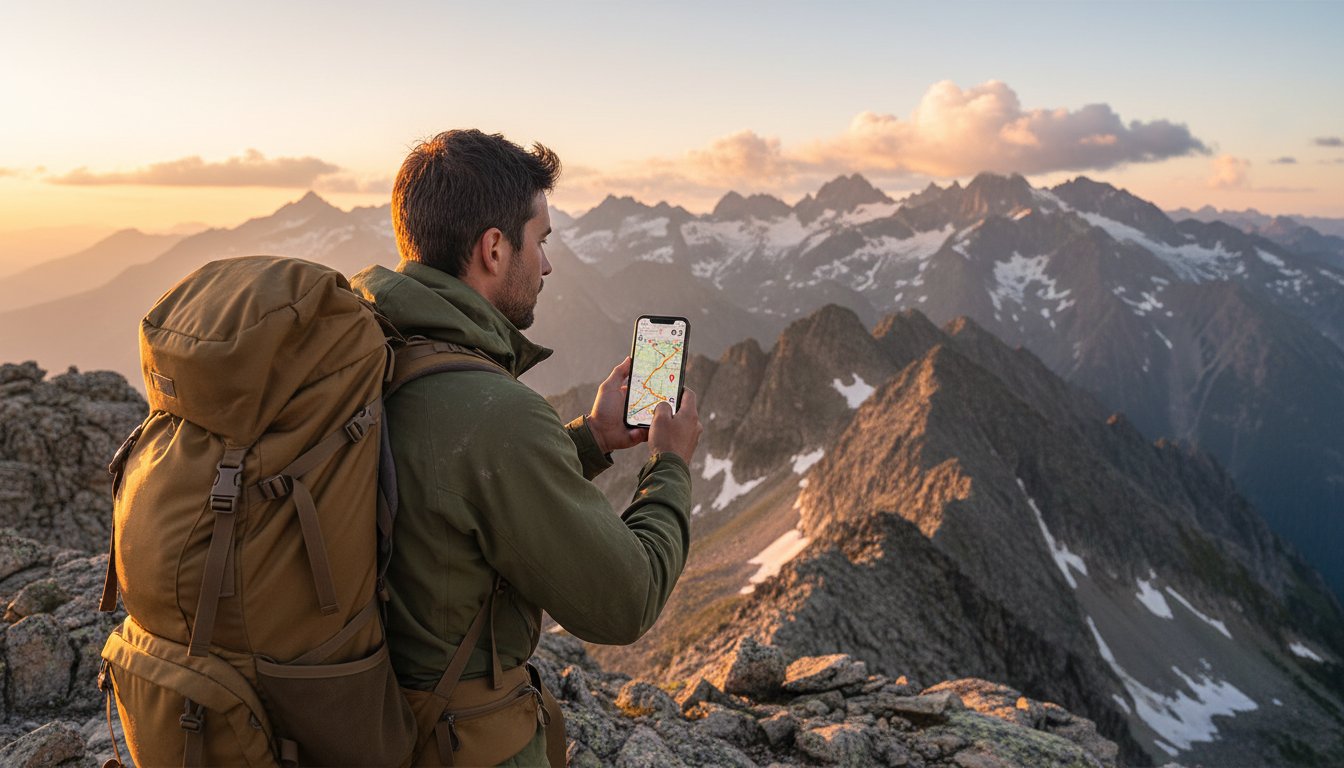
Information, trail maps, weather & more — anywhere on Earth.
No app needed, just use SMS or satellite texting.
Off-grid connectivity for the modern adventurer.
Get Started in Seconds
1. Sign Up
Register with your phone number. No complex sign-up forms.
2. Ask RidgeText Anything
Text RidgeText while on your adventures and receive AI assistance anywhere on Earth. See the How-To for examples.

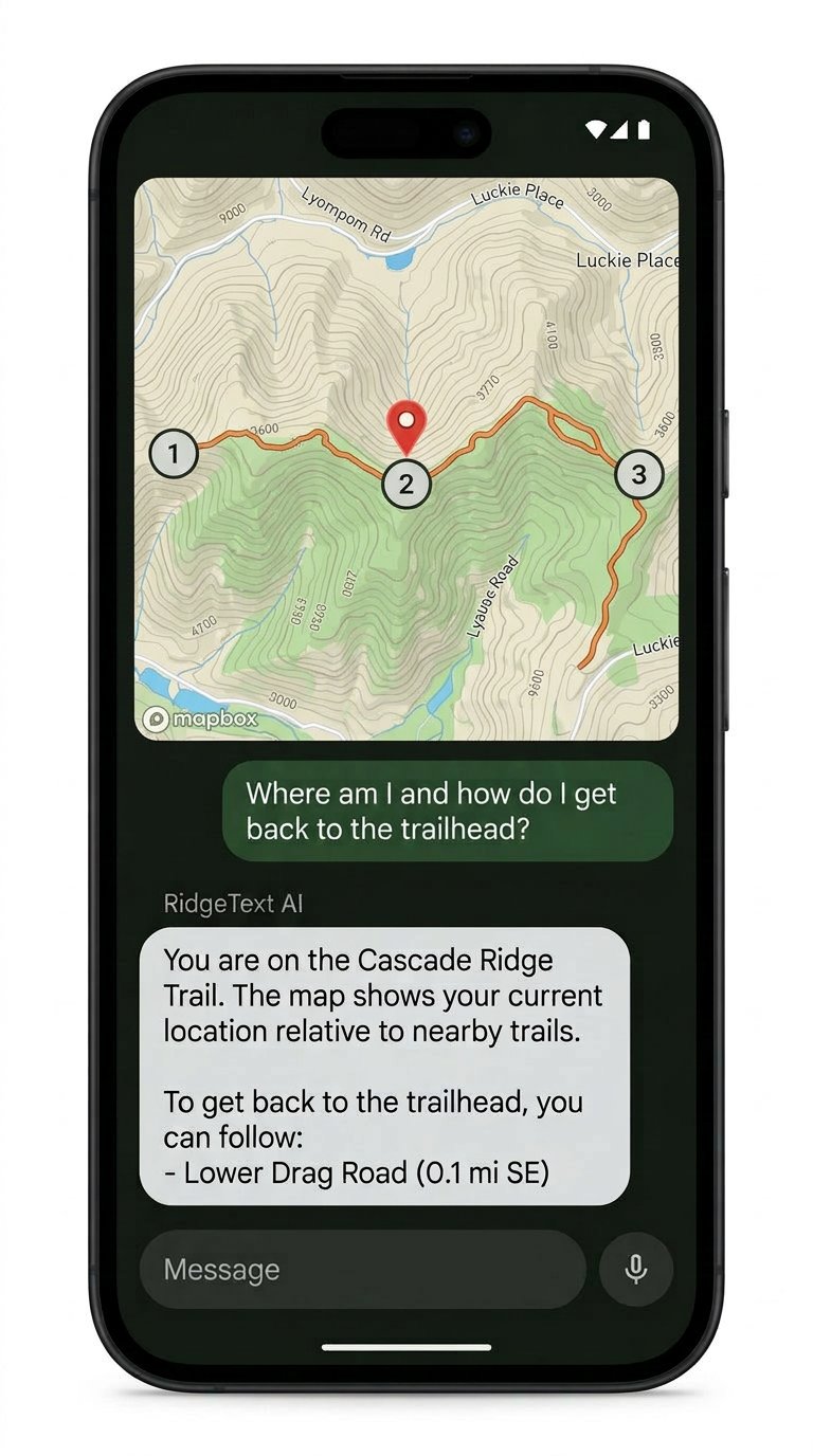
Trail Maps
Send your location and receive a topographic trail map with your route highlighted.
Real-Time Weather
Get summit-level forecasts for your exact coordinates, before and during your hike.
Safety Guidance
First aid tips, emergency info, and survival guidance available anywhere on Earth.
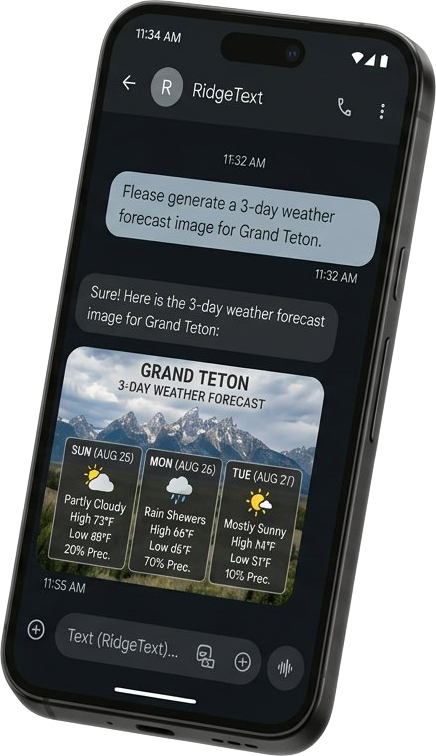
Photo Analysis
Snap a photo of a plant, injury, or landmark and get an instant AI-powered answer.
Voice Messages
Send a voice note instead of typing. Perfect for hands-free use on the trail.
Satellite SMS Ready
Works with satellite texting plans and services that support SMS through satellites.
AI-Powered Adventure Intelligence
RidgeText is an intelligent AI agent accessible primarily through SMS using regular cell phone signal or satellite texting anywhere in the world. It provides outdoor enthusiasts with valuable information, including trail maps, weather information, and safety guidance, even in the most inaccessible places.
And it doesn't stop at the trailhead. RidgeText works anywhere your data signal fades: a remote campsite, a subway tunnel, or even the grocery store. If you can send a text, you have a personal AI assistant in your pocket. No app to download, no Wi-Fi to hunt for, no subscription to a device you only use twice a year.
How We Stack Up
Trail Intelligence, Without the Hardware Bill
RidgeText isn't a satellite communicator. It's an AI trail assistant that works on the phone you already own, including via satellite SMS. Pair it with your gear, or just use it on its own.
| Feature | RidgeTextfrom $4.99/mo | Garmin inReach$300–500 + $14.95/mo | SPOT$150–250 + $11.95/mo | Zoleo$199 + $20/mo | AllTrails$5.99/mo |
|---|---|---|---|---|---|
| No hardware required | ✓ | — | — | — | — |
| Works on your existing phone | ✓ | — | — | — | ✓ |
| No app or data plan needed | ✓ | — | — | — | — |
| AI-powered trail assistance | ✓ | — | — | — | — |
| Trail maps & navigation | ✓ | ✓ | — | — | ✓ |
| Real-time weather forecasts | ✓ | ✓ | — | ✓ | ✓ |
| Photo & voice analysis | ✓ | — | — | — | — |
| Satellite SMS compatible | ✓ | ✓ | ✓ | ✓ | — |
| Two-way satellite messaging | via carrier | ✓ | ✓ | ✓ | — |
| Dedicated SOS / emergency beacon | — | ✓ | ✓ | ✓ | — |
Pricing and features based on publicly available information. Satellite SOS requires a dedicated satellite device. RidgeText is not a substitute for emergency communications hardware.
Your Pocket Guide
Everything You Need on Your Adventure
Trail Maps
Topographic maps with your route and nearby hikes.
⛅Weather Forecasts
Real-time forecasts for your exact coordinates.
Safety Guidance
First aid tips and emergency info anywhere on Earth.*
Photo Analysis
Identify plants, landmarks, or injuries from a photo.*
Maps & Directions
Find campgrounds, gas stations, and restaurants nearby. Get driving, walking, or biking routes to any destination.
Notes & Reminders
Save notes and set reminders sent to you via text.
Satellite SMS
Works with satellite texting plans and services.
Works Anywhere
No app, no data plan. Just send a text.
Image Generation
Get AI-generated images of landmarks, wildlife, and more.
🎨Photo Editing
Enhance your photos with a simple text request.
💬Free messaging in 180+ countries, satellite included.
Voice Messages
Send a voice note instead of typing.
PDF Analysis
Ask questions about any trail map, manual, or guide.
Video Analysis
Send a YouTube link and get instant answers.
Calendar
Get your upcoming events sent right to your phone.
Personalized
Metric or imperial, your timezone, your preferences.
* AI-generated responses are for informational purposes only and are not a substitute for professional medical advice. Always consult a qualified healthcare provider for medical concerns.
Ready to explore?
Start with a free plan and text RidgeText from wherever your adventure takes you.