What RidgeText Can Do
Powerful Features.
Zero Apps.
Weather, maps, AI images, and more — all through a single text message.
30+
Countries supported
No app
Required to get started
SMS & WhatsApp
Works on any phone
Available Now
Every feature works over standard SMS — no data plan, no Wi-Fi, no app.
Advanced Weather
Interactive radar maps, historical data, and detailed 10-day forecasts for any peak, trail, or location — all delivered via SMS.
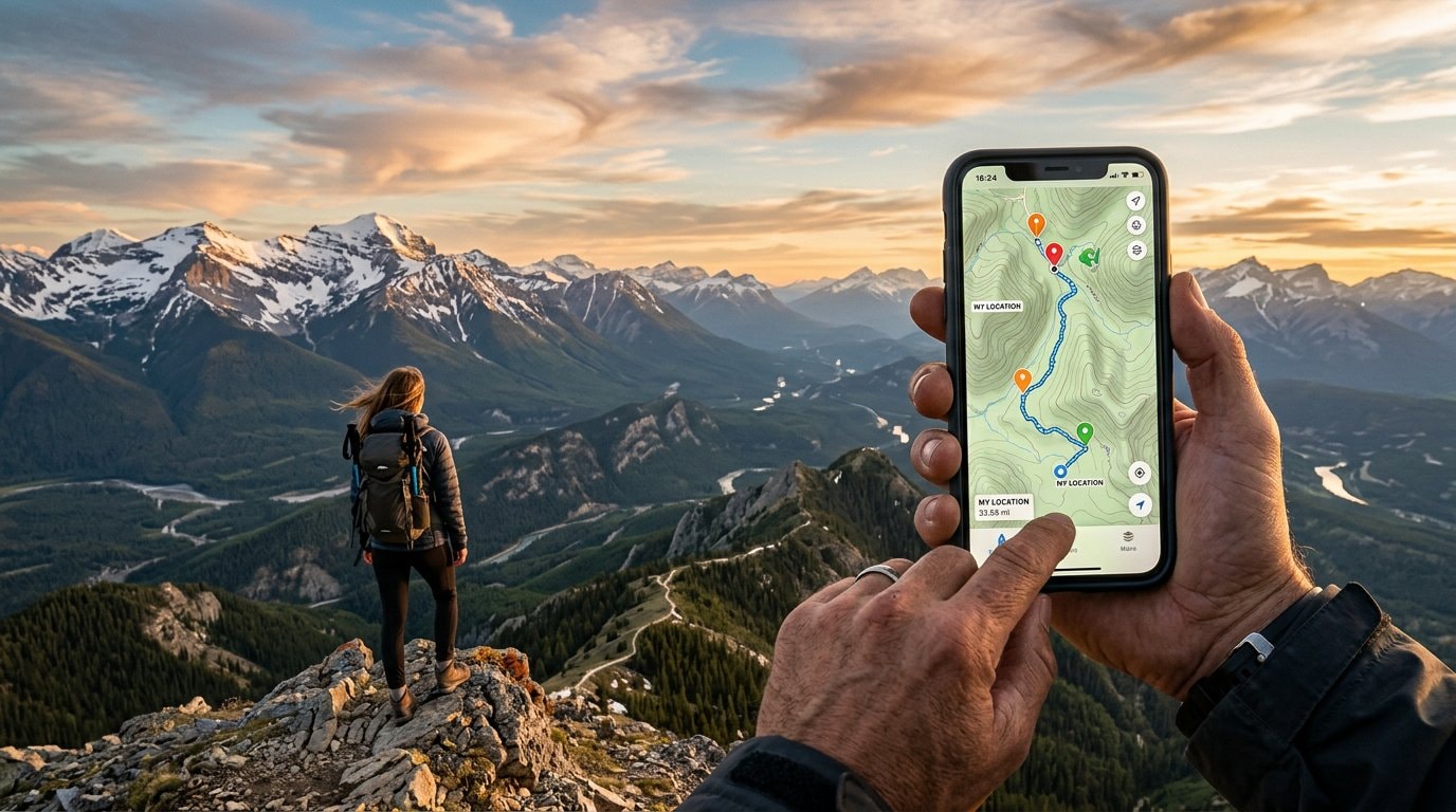
Trail Maps
Get topographic trail maps, turn-by-turn directions, and emergency location assistance sent straight to your phone — no data required.
AI Image Generation
Describe anything and receive a stunning AI-generated image via MMS. Landscapes, gear ideas, trail illustrations — just ask.
AI Image Editing
Send a photo or an AI-generated image and ask RidgeText to edit it — adjust style, add elements, or transform scenes, right in your SMS thread.
WhatsApp Integration
Use RidgeText from WhatsApp and reach 180+ countries. Works over WiFi, cellular data, or satellite — no US phone number required.
Notes & Reminders
Save gear lists and waypoints via SMS, and set reminders that actually execute — get a weather forecast delivered every morning, not just a notification.
Contacts
Relay trail maps, weather reports, images, and more to your contacts via SMS — even when you have no data. RidgeText acts as your internet-connected messenger.
Live Location Tracking
Share a Google Find Hub link via SMS and RidgeText tracks your route every minute. Get a trail map delivered automatically when sharing ends.
International Support
Available in 30+ countries with GDPR compliance and regional carrier support. RidgeText travels wherever you do.
Coming Soon
We're building new features to make RidgeText even more useful in the backcountry and beyond.
Wildfire Alerts
Real-time fire perimeters, containment status, and air quality via SMS.
Ready to explore?
Start with a free plan and text RidgeText from wherever your adventure takes you.